Coles Bay, Tasmania, Australia

Today we have a second blog about Coles Bay, following from our previous blog:
Showcasing the natural beauty of the Freycinet Peninsula,Tasmania. We have had requests from a couple of subscribers to know more about this beautiful area in Tasmania.
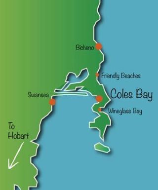
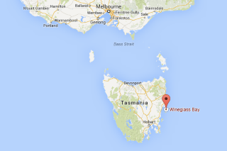
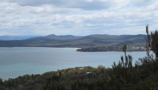
Coles Bay is the town at the entrance to Freycinet National Park. It is a small bay that is part of the Great Oyster Bay, 193 km north east of Hobart, Tasmania and 174 km south east of Launceston.
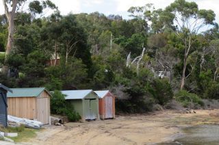
The population of Coles Bay is roughly 500 people, but it swells enormously over the summer months, as people come to the area to swim, fish, relax or enjoy the numerous walks and hikes around the Freycinet Peninsula. There are plenty of choices for accommodation - a caravan park, camping ground, upmarket eco lodges, or there are numerous houses available to rent (including in nearby Swanwick). There are two small groups of shops, some distance apart, which cater for basic needs, plus a couple of restaurants. Coles Bay hasn’t changed much at all in recent decades, and so still retains the natural charm the whole area is famous for.
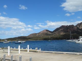
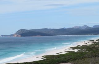
As you approach the town, you can see the Hazard Mountains up ahead. The Hazards are said to be named after a local whaler, African-American Captain Richard Hazard. The range consists of 5 mountains; Mts. Mayson, Amos, Dove, Baudin and Parson.
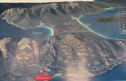
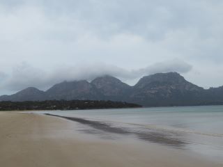
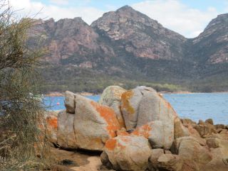
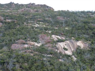
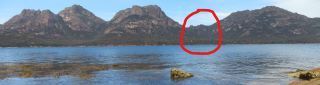
The area is made up of two huge eroded blocks of granite which form the Hazards and Mount Freycinet. They are joined by a narrow isthmus which has the park's most impressive feature, Wineglass Bay on the eastern side. I’ve marked in one photo below where the path into Wineglass Bay is, between Mt Amos and Mt Parsons.
History of the area
Here is a snapshot of the history of the area: (Credit: aussietowns.com.au)
- Prior to the arrival of Europeans the area was occupied for at least 35,000 years by people from the Paredarerme Aboriginal language group.
- In 1642 Abel Tasman sailed past the peninsula and named it Vanderlin's Eylandt. The peninsula was renamed Freycinet after the brothers, Henri and Louis de Freycinet, who sailed along the coast with Nicolas Baudin in 1802.
- By the early years of the nineteenth century European sealers and whalers were operating on both Freycinet Peninsula and Schouten Island.
- The town was named after Silas Cole, a lime burner who collected the shells from the Aboriginal middens and burnt them for lime.
- In 1916 Freycinet Peninsula became a National Park.
- No settlement developed in the area until the 1930s. It was only ever a few isolated fishermen and hermits.
- From the 1930s until the 1990s Coles Bay was a small community of shanties and huts on the edge of a beautiful bay.
- On the first Royal visit to Australia in 1954, the Royal Yacht Britannia anchored in Wineglass Bay to allow the Queen and Prince Philip to go ashore for an Australian-style beach barbecue. What a memorable view of beautiful, untouched Tasmania they would have had!
Walks in Freycinet (Credit aussietowns.com.au)
There are ten walks of varying difficulty ranging from under two hours to 4-8 hours. The most famous of these is the spectacular Wineglass Bay/Hazards Beach circuit, but here are a few others too:
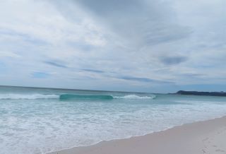
Wineglass Lookout - This may be a medium walk of 60-90 minutes return but it is all up hill and then, when you return, all downhill on a loose gravel surface. The reward is one of the most beautiful views in Tasmania. From the lookout there are superb panoramas of the white arc of sand that is Wineglass Bay.
Wineglass Bay - if you continue over the hill from the Wineglass Lookout you will reach Wineglass Bay. It is a 2.5 - 3 hour return walk of over 1000 steps down and of course, over 1000 steps back up again! We recommend a leisurely walk along the beach in between! A four hour boat cruise into Wineglass Bay also operates from Coles Bay, and day trips can be taken from Hobart or Launceston.
Wineglass Bay/Hazards Beach circuit - You head out around the coast, cross the isthmus, walk along Wineglass Bay, climb up to Wineglass Lookout and then head back to the car park. It takes around 4-5 hours but the first section (or the last section if you do it in reverse) is flat and easy.
Hazards Beach - this is a serious walk lasting 5-6 hours which continues to the southern end of Hazards Beach and then returns and joins up with the Wineglass Bay/Hazards Beach circuit.
Mount Amos - this three hour (return) walk is a track to the summit of one of the Hazards. It does involve some scrambling over rocks, so is far from being a gentle stroll. The reward for the effort is spectacular views up and down the coastline.
Scenic Lookout, Friendly Beaches – not far from Coles bay there is a turnoff to a dirt road which takes you down to the beach. The lookout is a five minute walk from the car park off Isaacs Point Road, and offers a fine view along the length of the Friendly Beaches.